Vehicle Accident Reconstruction
Critical Guidance Engineering (CGE) provides advanced expert accident reconstruction services and analysis throughout the United States for attorneys and insurance professionals. Our team of licensed and registered forensic engineers have extensive experience investigating and reconstructing accidents, most of which require specialized knowledge related to the highly sophisticated and digitized world we live in today. Using state-of-the-art technology and software, CGE has the resources necessary to properly preserve and evaluate scene evidence and collision data associated with today’s high-tech vehicle systems. In addition, CGE has the ability to produce illustrative physics-based animations and graphics and interactive presentations to communicate our professional analysis and opinions during legal proceedings. At CGE, our experts possess the expertise and proficiency required to successfully analyze highly complex collision incidents while providing our clients with easy-to-understand findings crucial for achieving a successful case resolutions.
Inspections
Laser Scanning
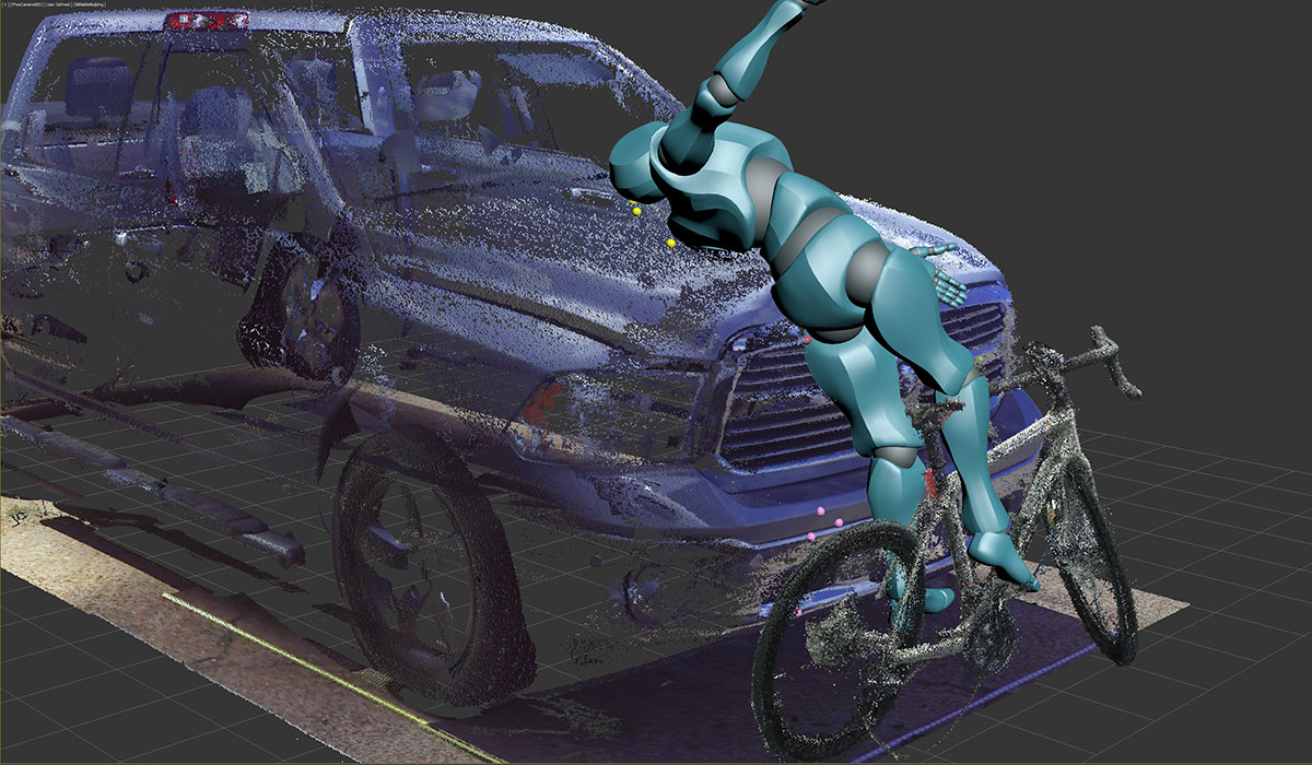
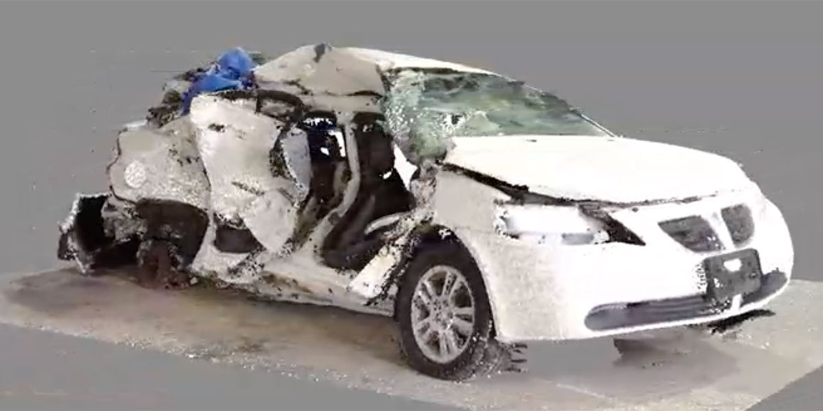
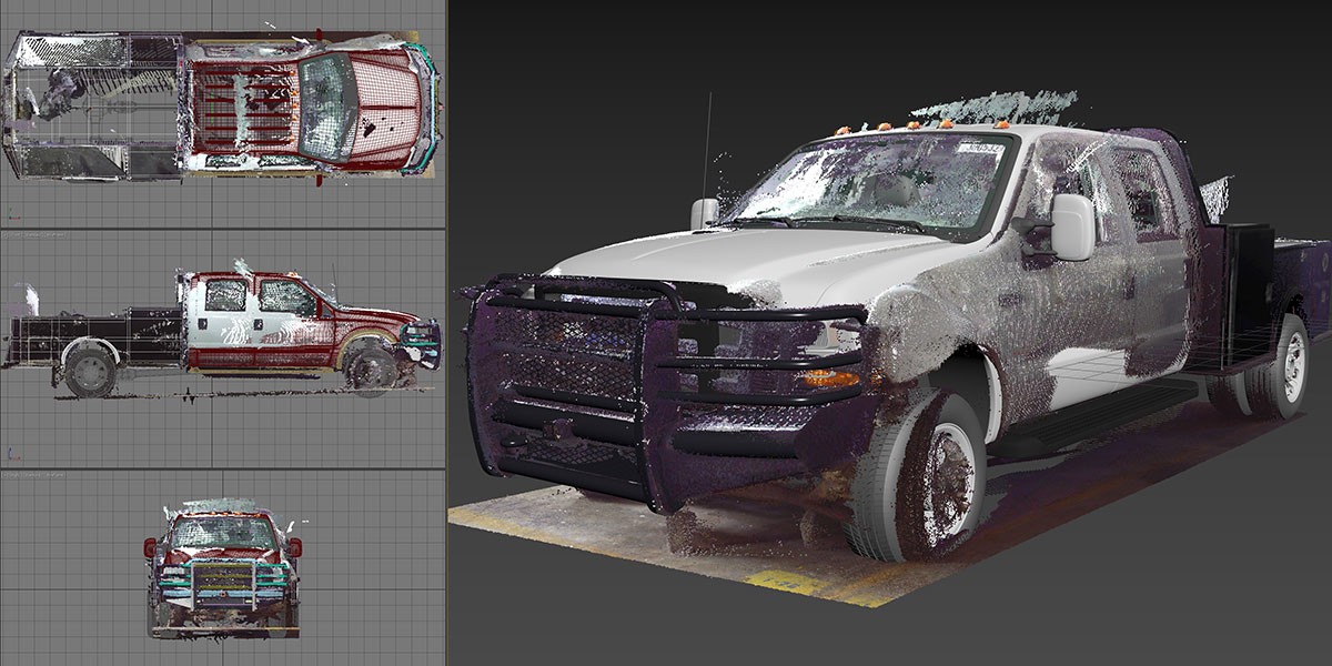
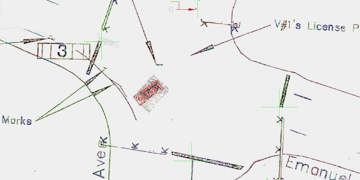
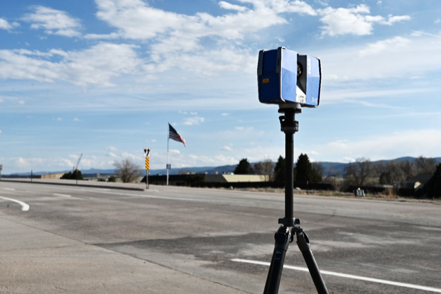
Three-dimensional (3D) laser scanning technology is a powerful tool that can be used for forensic investigations involving accident reconstruction. With the ability to capture millions of data points in a matter of minutes, our investigators are able to document a scene, and crash related evidence in a way that is impossible to achieve with traditional methods. The data collected using this technology provides our forensic engineers with the ability to reconstruct the exact position and collision orientation of vehicles and crash related evidence within the scene environment with highly accurate and detailed 3D models that can be used to visualize the scene virtually for effective scene diagrams and physically accurate animations. Additionally, 3D scanning provides a digital copy of crash related vehicle and scene evidence effectively preserving the data for future analysis. Overall, 3D laser scanning provides a powerful tool for forensic investigators to gather, analyze, and preserve evidence in a way that is more accurate, efficient, and reliable than traditional methods.
Photography
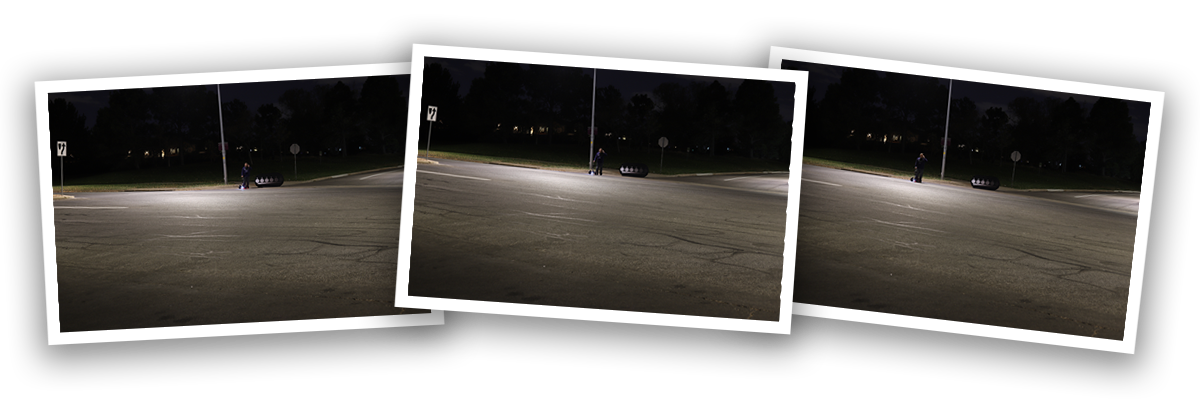
Skilled photography is essential in vehicle accident reconstruction cases, providing a vital visual record of evidence. Forensic investigators rely on photographic documentation to reconstruct events leading to crashes, determine causes, and support expert opinions in legal proceedings. The quality and perspective of photographs are crucial, reflecting the investigator’s skills. Precise measurements through photogrammetry may be required, necessitating high-quality photos from multiple angles. Specialized lighting and visibility conditions may also need documentation, requiring expert knowledge for calibration and processing. CGE’s experts understand the importance of high-quality photos, considering perspective, lighting, and depth of field to capture case-related details accurately.
Drone Videography & Photography
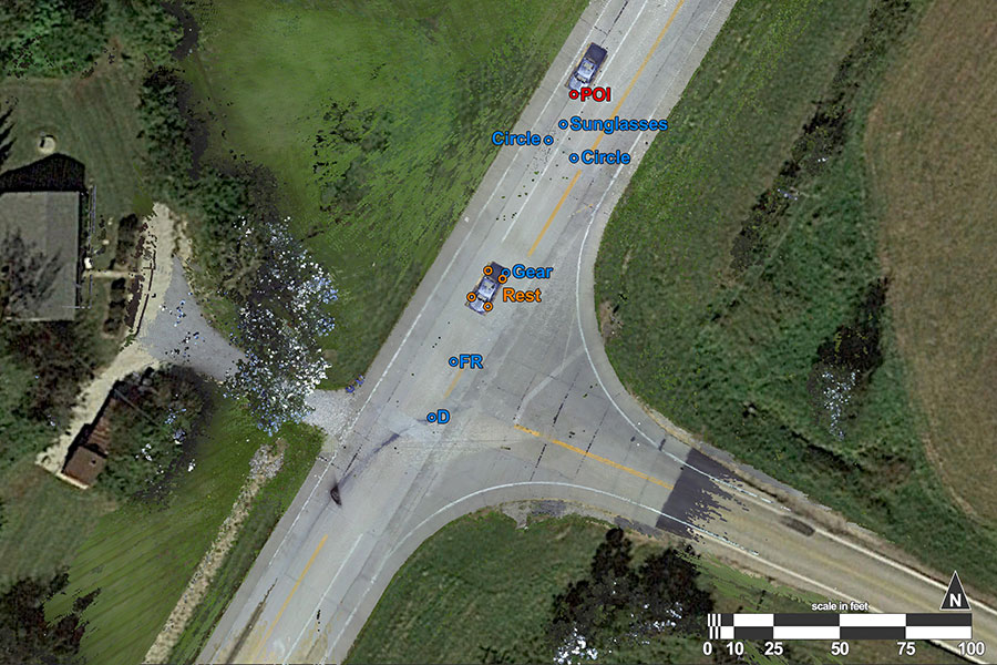
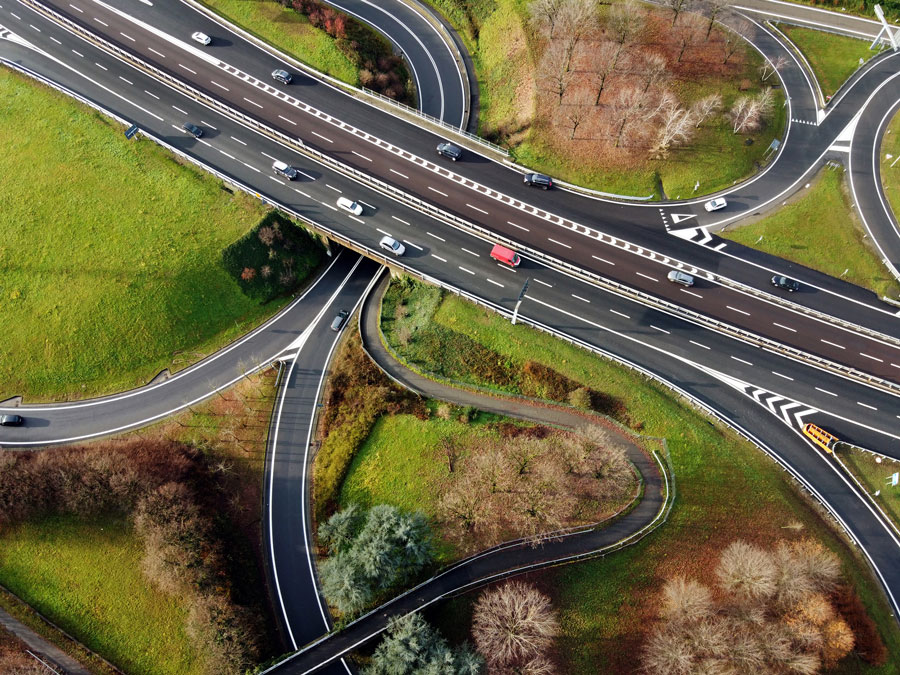
Drone imagery can be an extremely valuable tool in forensic investigations of vehicle collision as they allow for a detailed and comprehensive documentation of evidence that may not be visible or even recognizable at ground level. Drones are capable of capturing high-quality aerial footage and images from a collision scene with the ability to reveal crucial details that might be overlooked from ground level. This can include skid marks, gouge marks, police reference marks, and other physical evidence that can provide basis to a reconstruction analysis. Additionally, drones can be equipped with specialized cameras, such as thermal imaging or LIDAR, and can detect and record information that might not be visible to the naked eye. Overall, drone technology can significantly enhance the accuracy and effectiveness of mapping scene evidence for forensic investigations providing valuable insights that can help determine the causes and contributing factors of an incident.
Digital Evidence
CGE provides advanced expert accident reconstruction services with the tools necessary to investigate and reconstruct accidents involving today’s modern and highly sophisticated vehicles. Most vehicles driving on the road today have the ability to capture elements of crash related data. Using state-of-the-art technology and software, CGE has the resources necessary to properly preserve and evaluate scene evidence and collision data associated with today’s high-tech vehicle systems.
Airbag Control Modules
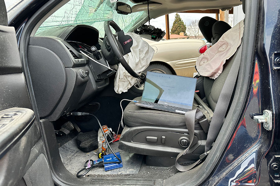
Most passenger vehicles today are equipped with an Airbag Control Module (ACM), also known as an Event Data Recorder (EDR), designed to collect crash-related data during collisions. These EDRs are regulated by the federal government to record specific crash conditions and capture vehicle dynamic data leading up to and during a crash. They provide crucial information like vehicle speed, driver behavior, and impact severity. While EDR data is usually presented in user-friendly formats like Bosch Crash Data Retrieval (CDR) reports, interpreting it often requires the expertise of a trained forensic engineer. CGE possesses the skills and knowledge needed to acquire and analyze EDR data, combining it with scene evidence to determine the critical factors contributing to a collision incident.
Heavy Truck Control Modules
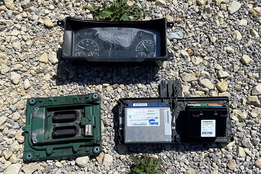
Today’s heavy trucks are equipped with various computer systems capable of capturing and storing crash-related data. These systems, notably the Engine Control Module (ECM), continuously record data, including speed, clutch and brake usage, and cruise control operation before and after a collision. The recorded data is instrumental in reconstructing collision events. Primarily triggered by a “hard brake” or “last stop” event, the control modules capture relevant data, ensuring crash information is retained if the driver slows down significantly during or before an accident, if the truck is preserved post-incident. Additionally, heavy trucks may have independent systems like collision avoidance and Anti-lock Braking Systems (ABS) gathering crash data. Many trucking companies employ onboard video cameras, GPS trackers, and proprietary telematic systems to monitor drivers, providing further insights into events leading up to collisions. At CGE, our expertise lies in obtaining and accurately interpreting heavy truck data, offering valuable insights into the critical factors contributing to collision incidents.
Personal Devices – GPS, cell phones, infotainment systems
Personal Devices – GPS, cell phones, infotainment systems
Personal devices such as cell phones, GPS monitoring devices, and infotainment systems can be used to track the dynamics of a pedestrian, bicycle, motorcycle, passenger vehicles and heavy trucks and can be used to determine the events that led up to a crash incident. These devices can provide valuable data such as a person’s speed, location, and direction of travel, which can be used to create a detailed picture of the events leading up to a collision. For example, a cell phone’s GPS can provide information on the location of the user and the time of the crash, while an infotainment system may provide information on the speed and direction of the vehicle, operation of applications within the infotainment system, and cell phone usage prior to or at the time of the collision. This data can be utilized to determine if additional factors such as the speed of the vehicle or use of technology involved or other. By using this information, accident investigators can reconstruct the events leading up to a crash and determine the cause of the collision.
Vehicle Modeling
Vehicle Modeling
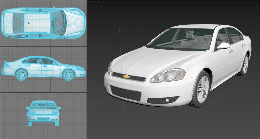
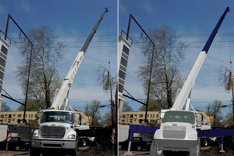
CGE uses highly accurate 3D models of vehicles to analyze and show the evidence of physical damage that occurred during collision incidents. These models help CGE engineers evaluate the impact geometry between vehicles within the scene environment, giving them a scientific basis to determine the cause and circumstances of the collision. To create these models, photographic evidence of impact damage to the vehicles is analyzed using photogrammetry or 3D scans of the vehicles involved in the collision. By accurately modeling the impact configuration and vehicle alignments at the time of the collision, CGE can determine the collision forces and the relative speeds of each vehicle involved. This information, combined with other evidence from the case, can be used to scientifically reconstruct the collision and determine who caused or contributed to the incident. Vehicle modeling and simulation techniques can also be used to evaluate hypothetical conditions that could have prevented or reduced the severity of a collision. Overall, vehicle modeling is a valuable tool for evaluating vehicle collisions and can provide valuable insights into the causes and contributing factors associated with crash incidents.
Crush Analysis
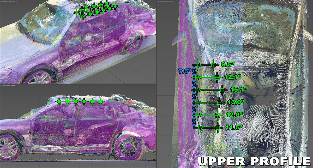
CGE provides analysis of vehicle crush damage to accurately determine the vehicle dynamics associated with a collision event. By referencing crash test data from vehicle manufacturers, NHTSA, SAE, and other independent crash test studies, CGE can examine the deformation and displacement of a vehicle’s structure and establish important case information such as vehicle impact speeds, principle direct of force, angle of impact, and pre-impact headings prior to the collision event. Using the crush damage analysis to understand the associated vehicle dynamics of a collision can also provide valuable insights into the conditions that were causal or contributed to the crash incident. In addition, crush analysis can be used in combination with data collected from a vehicle Event Data Recorder (EDR) to accurately analyze the vehicle dynamics and to evaluate the effect of the collision with other vehicles. Further, crush analysis can be used as a secondary method to reconstruct a collision incident when alternative methods, such as a momentum analysis, is unreliable due to vehicle weight differences or lack of scene data identifying the point of impact and points of rest of the involved vehicles. Therefore the evaluation of vehicle crush damage can be a critical tool for reconstructing a collision incident and determining the cause and contributing factors of a crash.
Evidence Matching
Scene Modeling & Building Terrain
Scene Modeling & Building Terrain
USGS Modeling/Laser Scanner Combined Point Clouds
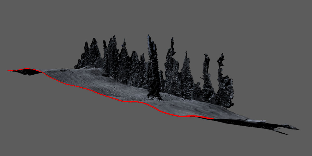
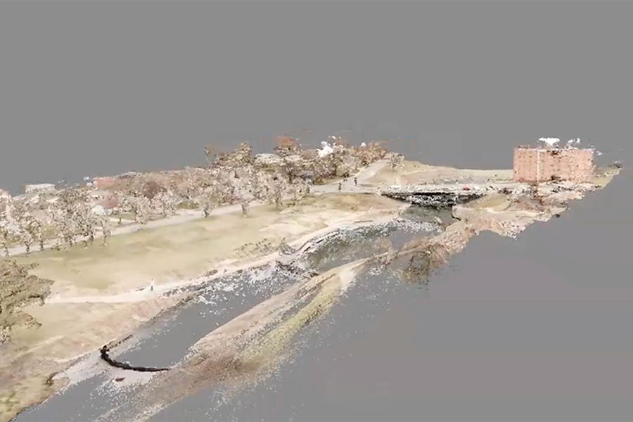
The combination of USGS aerial LiDAR imagery and high-definition laser scans offers a powerful approach to generating detailed terrain and 3D models of physical evidence for accident reconstruction. Aerial LiDAR data, collected by remote sensing technology, enables the creation of accurate digital elevation models (DEMs) representing the terrain of the accident site without obstructions. On the other hand, high-definition laser scans, obtained through terrestrial laser scanning systems, capture intricate details of the physical evidence at the scene, such as vehicles, debris, and road markings. By integrating aerial LiDAR-derived DEMs with high-resolution laser scans, investigators can create a comprehensive and accurate 3D representation of the accident environment, encompassing both the macro and micro scale. This fusion of data sources allows for a better understanding of the site’s topography, road geometry, and the positioning of involved objects. Moreover, it aids in the analysis of factors like visibility, vehicle dynamics, and collision forces. The resulting 3D models serve as a robust foundation for reconstructing the accident, facilitating the identification of its causes and the development of targeted safety improvements.
Aerial Photos
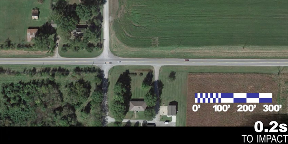
Aerial photography plays a significant role in accident reconstruction by providing a bird’s-eye view of the accident site, capturing crucial details that may not be readily visible from ground level. High-resolution aerial images can be obtained using drones, helicopters, or fixed-wing aircraft, and these images can be used to create a comprehensive and accurate visual representation of the accident scene. This aerial perspective allows investigators to assess the overall layout of the site, identify key landmarks, and document the position of vehicles, debris, and other relevant objects. By combining these aerial images with other data sources such as LiDAR-generated digital elevation models (DEMs), investigators can create a detailed 3D model of the accident environment, enabling them to better understand the factors contributing to the incident. Additionally, aerial photography can be used to establish sightlines and visibility, which are essential for analyzing driver behavior and decision-making processes leading up to the accident. Ultimately, aerial photography greatly enhances the accuracy and depth of information available for accident reconstruction, assisting in determining the causes and informing future safety improvements.
Photogrammetry
Photogrammetry, the science of obtaining precise measurements from photographs, is a valuable tool in the field of accident reconstruction. By analyzing a series of overlapping images captured at the accident scene, experts can generate accurate three-dimensional models of the site and involved vehicles. This process involves identifying common points in multiple photographs, allowing software to triangulate their positions in 3D space, resulting in a detailed and comprehensive representation of the scene. Photogrammetric techniques enable investigators to measure distances, angles, and elevations, which are crucial for evaluating factors such as vehicle speeds, impact forces, and collision dynamics. Additionally, these 3D models facilitate the visualization of key elements, including road geometry, sightlines, and visibility conditions, providing essential context for understanding the circumstances surrounding the accident. By incorporating photogrammetric data with other information sources, such as eyewitness accounts, vehicle telemetry, and surveillance footage, investigators can establish a robust foundation for determining the causes of an accident and identifying potential safety improvements to prevent future incidents.
Videogrammetry
Videogrammetry, the process of extracting precise measurements from video footage, has become an increasingly important tool in accident reconstruction due to the growing prevalence of surveillance systems, dash cameras, and body-worn cameras. By analyzing video sequences captured from various perspectives, experts can obtain crucial information regarding the dynamics and contributing factors of an accident. Videogrammetric techniques involve tracking identifiable features within the video footage and using these data points to calculate distances, velocities, and trajectories of the involved objects or vehicles. This information can be invaluable for reconstructing the sequence of events, estimating vehicle speeds, and determining impact forces during a collision. Furthermore, video footage can provide insights into factors such as driver behavior, reaction times, and environmental conditions, which are essential for understanding the circumstances leading up to an accident. By combining videogrammetric data with other sources of information, such as photogrammetry, digital elevation models, and eyewitness accounts, investigators can develop a comprehensive and accurate reconstruction of the accident, helping to identify its causes and inform potential safety improvements.


